📍 Location of the part near the Fleur-de-Lys arch
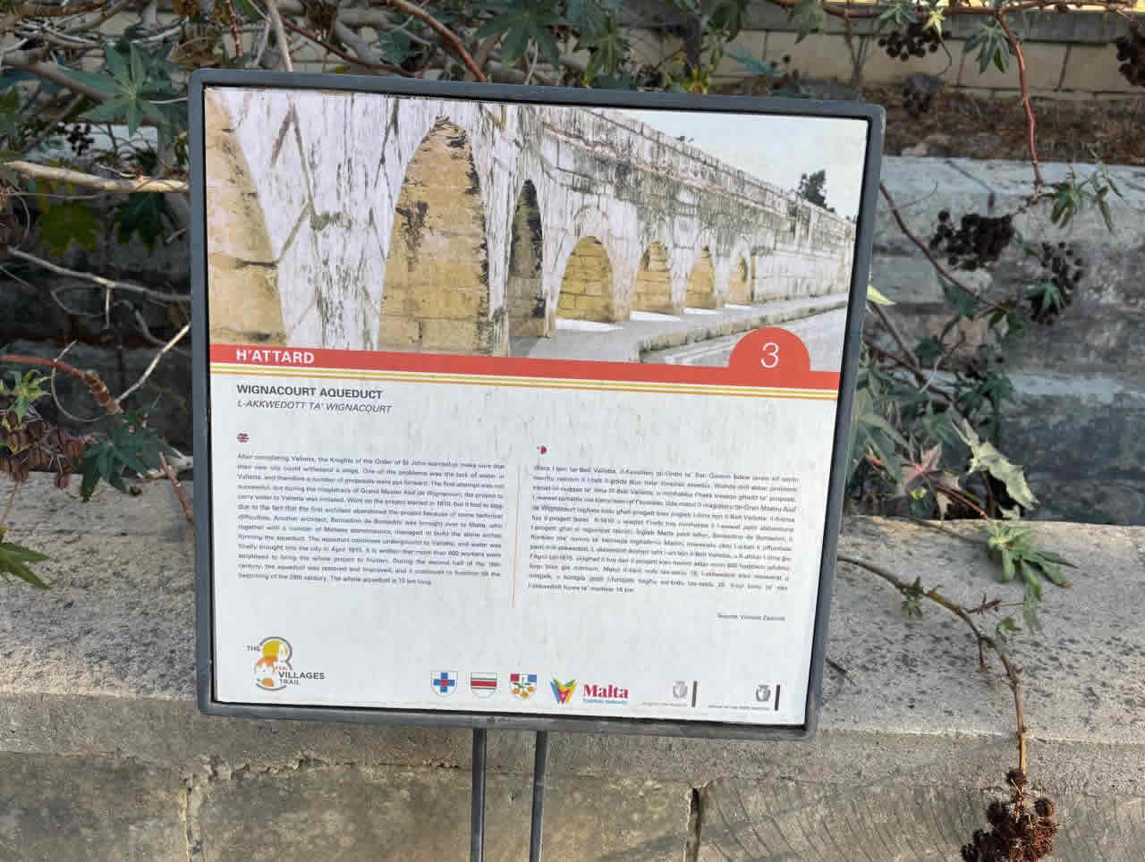
The Wignacourt Aqueduct
The Wignacourt Aqueduct carried water for about 15–16 miles (≈ 26 km) in total, from springs at Dingli/Rabat to Valletta.
Of this length:
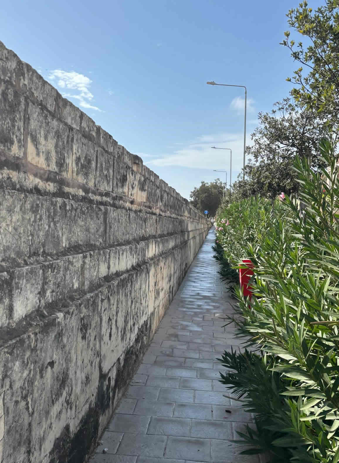
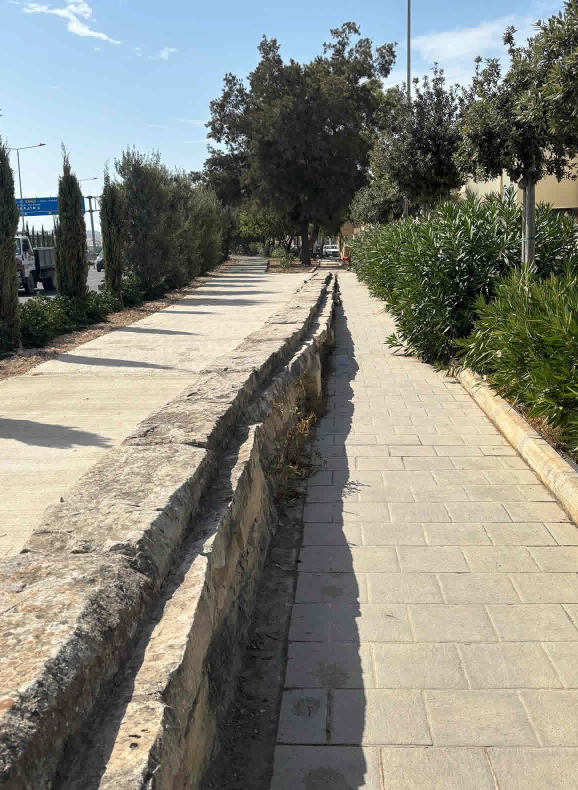
Most of the route was underground in channels or cut through rock.
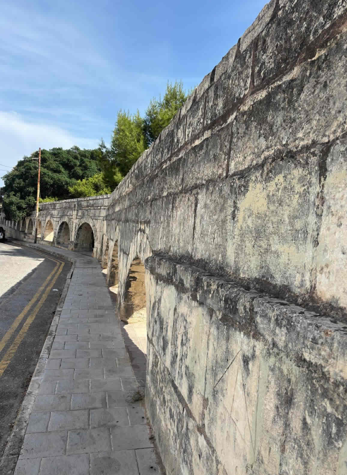
The above-ground arched section — the part people usually picture — was needed only where the land dropped into valleys (mainly between Attard, Balzan, Birkirkara, Fleur-de-Lys, and Santa Venera).
35.893210, 14.456180.
Wignacourt Aqueduct — full history, construction (the 17th-century aqueduct that brought water to Valletta) and the three associated inspection / water towers that survive today.
Why it was needed
Valletta (founded 1566–1571) needed a reliable fresh-water supply. Raincatchment and cisterns in the city were insufficient for a growing population and for the harbour/arsenal; the solution was to carry water by gravity from springs in the higher ground around Rabat/Dingli into the new capital.
Location 35.893165, 14.456384
The plan and the two attempts (1596 → 1610–1615)
A first attempt to pipe water to Valletta was launched under Grand Master Martin Garzez in 1596, but that early scheme stalled.
Work resumed under Grand Master Alof de Wignacourt. From 1610 engineers and master builders were engaged and the project was completed and inaugurated on 21 April 1615 — the date when water first flowed into Valletta. The aqueduct is therefore commonly known as the Wignacourt Aqueduct.
35.893285, 14.455476
Who designed and built it
Several engineers and capomastri (master builders) are recorded as taking part — notable names include Bontadino de Bontadini (a Bolognese engineer who arrived in Malta in 1612), Giovanni Attard and Natale Tomasucci. Construction was a major logistical and technical undertaking, requiring tunnels, underground conduits and above-ground arched viaducts where the ground dropped.
35.893423, 14.454404
Route, scale and engineering features
Source: Springs around Rabat and Dingli (higher ground west of Mdina).
Length & capacity: The aqueduct ran for many kilometres toward the east; modern summaries put the full route at roughly 26–27 km (measuring the historic watercourse) and a designed delivery capacity of around 1,400 m³/day (period figures vary by translation).
How it ran: The water flows underground for long stretches (stone pipes/channels) but—where the ground descended—stone arches/viaducts were built (the best-known surviving stretch is the row of arches through Attard/Balzan/Birkirkara). The line continues toward Fleur-de-Lys / Santa Venera and then into Hamrun/Floriana and Valletta, with the last section again underground.
35.893240, 14.447146
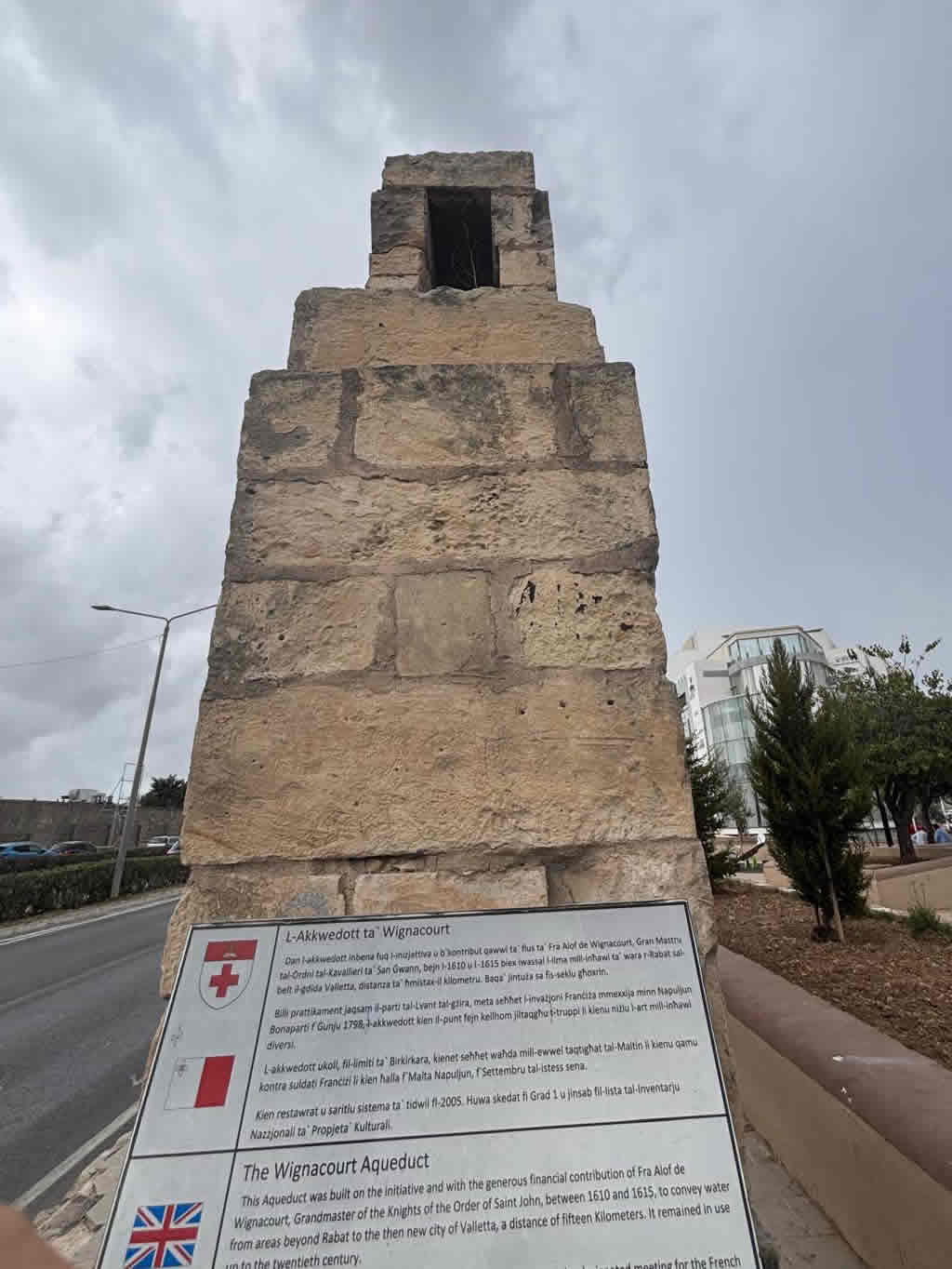
The inspection / water towers (the three surviving “turretti”)
As the aqueduct approached populated low ground it was necessary to inspect, store briefly and regulate flow. Three inspection / water towers were built and survive (in different conditions):
Sits where the arches meet the lower ground at Santa Venera. It has a buttressed lower level and two floors and resembles a small fortified turret. It is linked to the arched viaducts nearby.
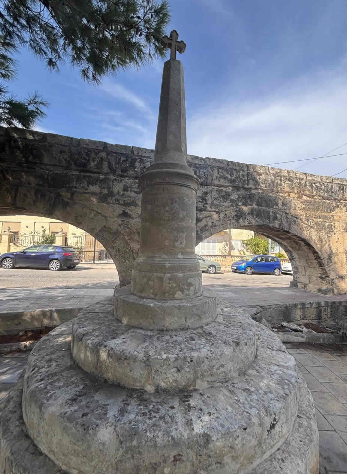
A round tower on the hill of St Nicholas, Hamrun. Historically the open tank in this tower managed flows and inspection. The tower is still standing but has at times been in a dilapidated state; nearby is an obelisk that commemorates later improvements of the system.
35.890060, 14.472709
The best known and most fully restored. It’s a circular, pilastered stone turret close to Argotti Gardens / Sarria Church in Floriana; it once contained an inspection tank and a fountain/horse-trough on its base. The tower bears the Order’s and Wignacourt’s coats of arms and a fleur-de-lis motif. It was included on Malta’s 1925 Antiquities List and has been restored (works completed c.2016) — interior spiral stair and stone details conserved, and the lion/stone trough repaired/replaced.
35.889987, 14.472870
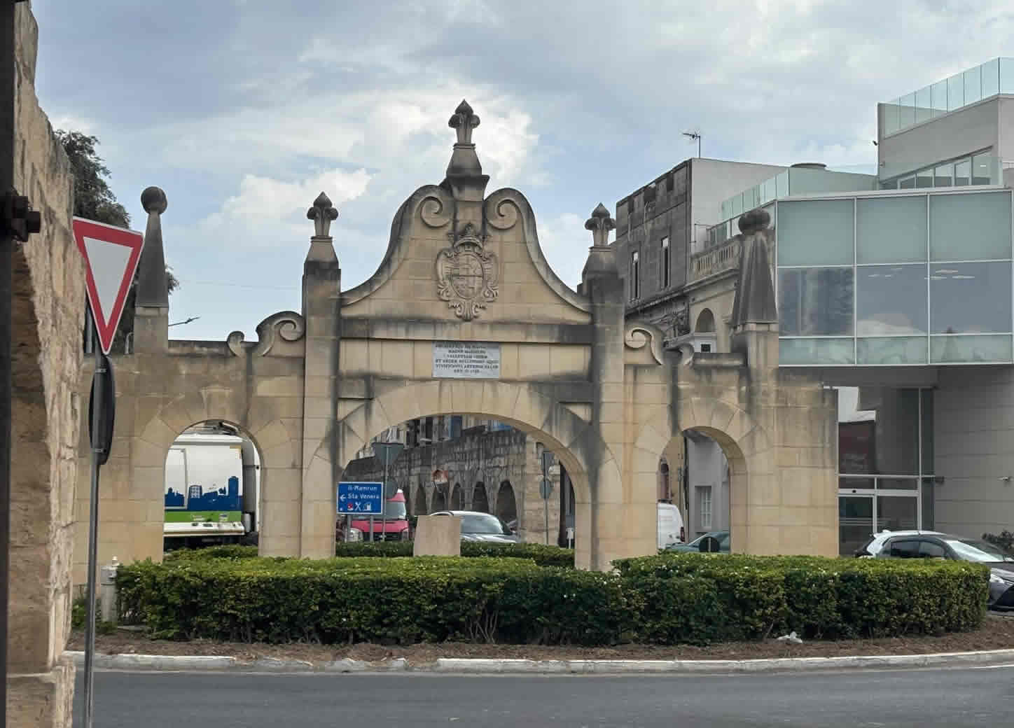
Wignacourt Arch (Fleur-de-Lys Gate) & commemorative works
Where the aqueduct crossed the Fleur-de-Lys / Santa Venera boundary the Wignacourt Arch (a triumphal gateway decorated with Wignacourt’s arms and fleurs-de-lis) was erected; it gave the locality its modern name. The original arch was demolished in 1944; a replica project was approved in recent years and the arch is commemorated in local heraldry.

National Archives of Malta PHO 1734
Later improvements and monuments
The aqueduct system was improved and repaired over the centuries (notably works under later Grand Masters such as De Rohan in the late 18th century), and commemorative obelisks and plaques were erected near some towers as recognition of those works. Some inscriptions and reliefs survive, though a number were damaged during modern events (including WWII).
Decline, survival & restoration
The aqueduct remained in use for centuries but was progressively superseded by modern waterworks in the 19th–20th centuries; the aqueduct ceased to be the primary supply in the 20th century. Many of the arched viaducts remain intact (notably through Attard, Balzan, Birkirkara, Fleur-de-Lys and Santa Venera). The Floriana water tower was restored in 2015–2016; Hamrun and Santa Venera towers survive in differing conditions. The Wignacourt aqueduct was celebrated on its 400th anniversary (21 April 2015) with local events.
Legacy & significance
The aqueduct is one of Malta’s most important early modern engineering works. It introduced large-scale hydraulic infrastructure and left a visible imprint on the Maltese landscape (arches, towers, fountains). Architecturally it also represents an early expression of Baroque public works on the islands, combining utility and civic pride. Many towns along the line still display coats of arms, plaques and local toponymy (e.g., Fleur-de-Lys).
Quick facts (summary)
Initiated: first attempt 1596; main works 1610–1615.
Inauguration: 21 April 1615 (water first flowed into Valletta).
Main engineers: Bontadino de Bontadini, Giovanni Attard, Natale Tomasucci (among others).
Route highlights: springs (Rabat/Dingli) → Attard/Balzan/Birkirkara arches → Fleur-de-Lys → Santa Venera (Turretta) → Hamrun (round tower) → Floriana (Wignacourt Tower) → Valletta.
Towers surviving: Santa Venera (Tower of St Joseph / it-Turretta), Hamrun (round tower), Floriana (Wignacourt Water Tower — restored).