The Fawwara Aqueduct
Google Map Link📍 Location of largest remaining sections of the Fawwara Aqueduct
Below is a concise, sourced history and a technical/construction summary of the Fawwara Aqueduct (Tal-Fawwara / Siġġiewi) in Malta.
Summary
What: a 19th-century British-period aqueduct bringing spring water from the Siġġiewi / Rabat–Dingli plateau area to supply the southern towns (notably the Three Cities/Cospicua) and neighbouring villages.
When built / opened: completed in 1845 (works and water arrival are documented in mid-1845).
Why built: a series of dry years in the 1830s–1840s revealed the island’s vulnerability; British authorities therefore commissioned additional public waterworks to augment the older Wignacourt supply. The Fawwara Aqueduct was the main project to relieve shortages in the south/Three Cities.
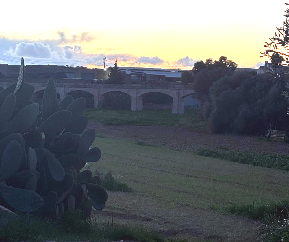
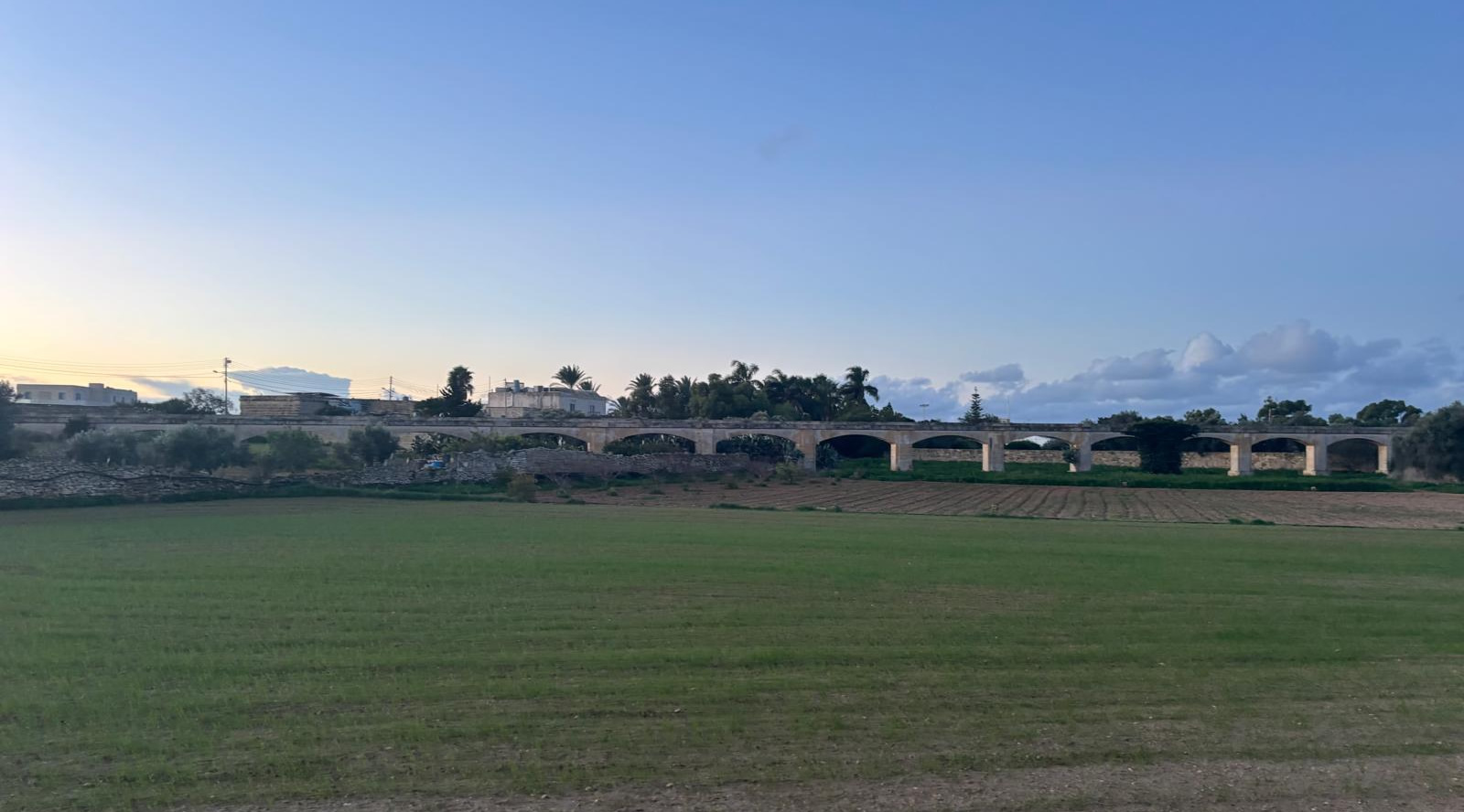
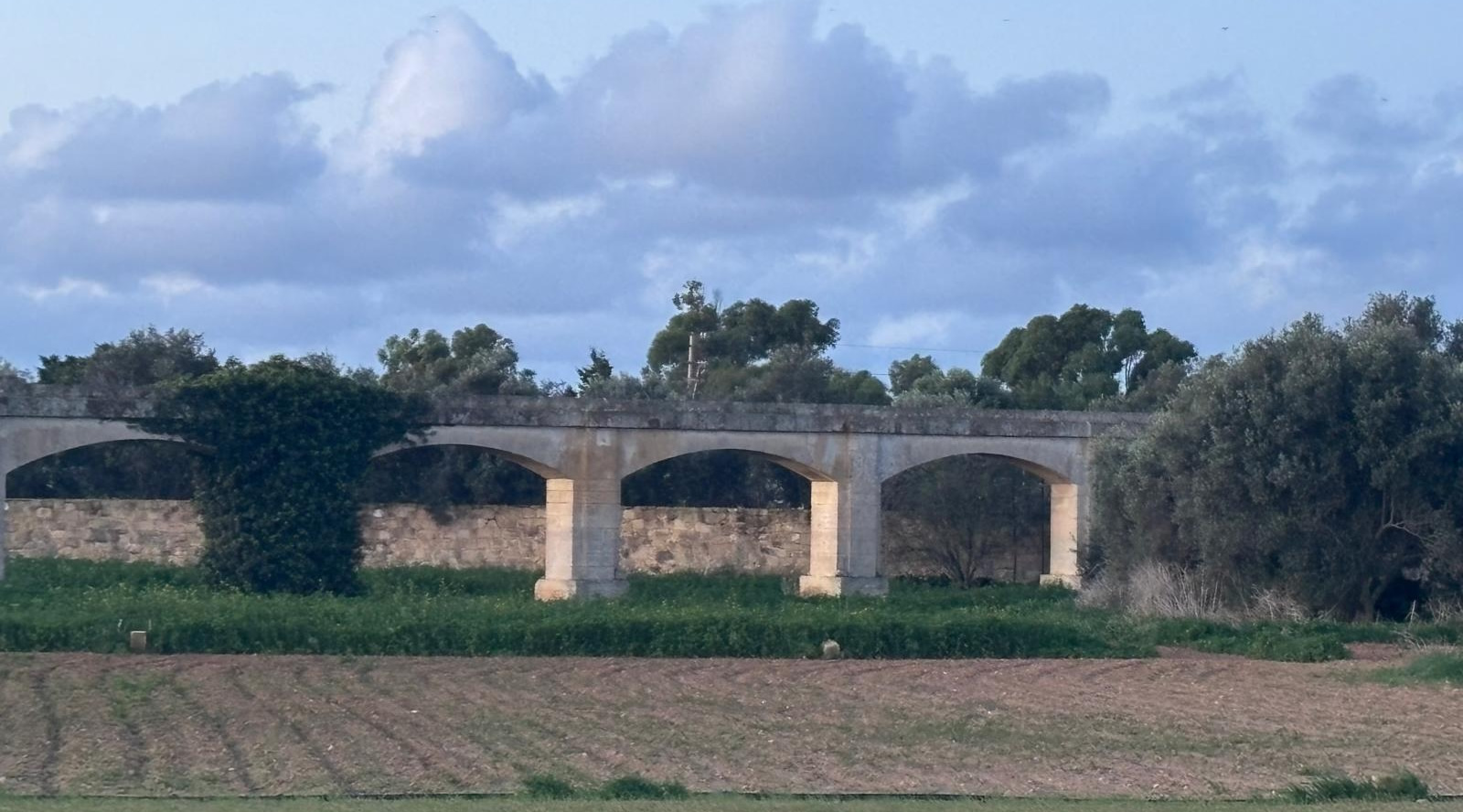
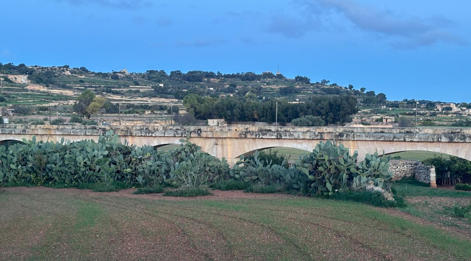
Current status: surviving stretches (arches and runs) survive in the Siġġiewi countryside and have recently been scheduled for heritage protection (Grade 2).
Historical context
1. Long-term water problem: Malta historically relied on rain cisterns and a few spring systems. The great Wignacourt Aqueduct (early 17th century) supplied Valletta and central/northern areas, but the south still suffered shortages when springs were weak. A run of dry years (c.1834–1841) forced the British colonial administration to search for extra spring sources and to install a new conduit to serve the south.
2. Commission & patronage: Governor-General Sir Henry Frederick Bouverie and the Public Works authorities initiated major waterworks in the 1840s; the Fawwara project was part of this mid-Victorian programme to improve public health and supply to growing population and military installations. Water reached the Three Cities area in 1845 and public celebrations were recorded.
3. Role in the distribution network: Contemporary reports (e.g., Chadwick, 1884, and later water-supply reviews) treat the Fawwara Aqueduct as the principal supply for the Three Cities and several southern localities; it was separate from and complementary to the Wignacourt system.
Construction & engineering details
What the records and surveys report; where explicit technical drawings exist they are in Malta Water Service / archival collections.
Sources & route
• The conduit tapped springs and gallery sources at the southern end of the Rabat–Dingli / Siġġiewi plateau (locally referenced as “Fawwara” / Fawwara springs) and carried the water east-wards to the Cottonera / Three Cities area (Cospicua / Bormla, Birgu, Senglea and adjacent towns). Maps and an 1884 record plan survive in public/Water Service archives.
Length & workforce
• Contemporary local accounts report the aqueduct route as about 9 miles (≈14.5 km) and note it employed several hundred workers during construction (reports say roughly ~300 labourers during the works of 1845). These numbers appear in local histories and archival summaries.
Type of structure and materials
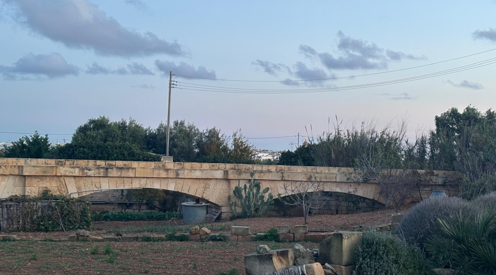
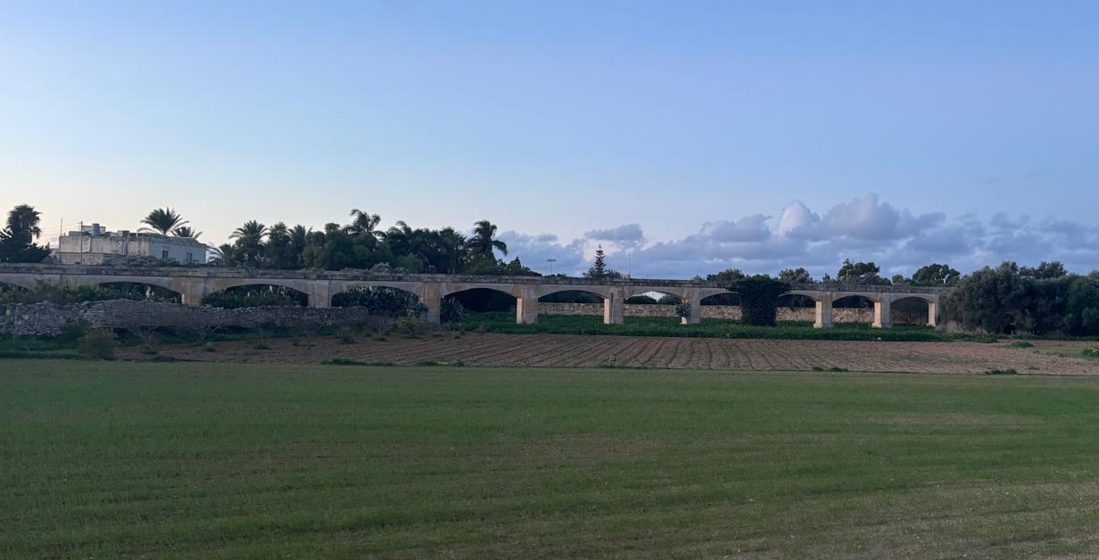
• The Fawwara line used the same pragmatic mix common in Maltese aqueduct engineering: buried conduits/channels and above-ground stone viaducts/arches where the ground dropped. Exposed sections in the Siġġiewi countryside are built in local limestone (the same coralline/limestone that Malta’s traditional masonry uses), with regular arches/culverts to cross depressions and fields. Where the ground permitted, closed conduits or underground channels were used to reduce contamination risk. Photographs and recent surveys show a continuous run of modest arches carved into the hillside in places.
Hydraulics and storage
• The Fawwara aqueduct was designed to move spring (gravity-fed) water by careful routing and modest gradients, delivering into storage tanks/reservoirs and the distribution mains in the Cottonera area. Later British reports quantify the island’s combined aqueduct outputs rather than giving a single figure for Fawwara alone, but contemporary records treat Fawwara as a significant supplement to the public supply. (For exact engineering drawings and flow figures look to the Water Services / National Archives material and the 1884 Chadwick report.)
Construction methods
• Excavation of open channels and buried stone conduits; stone masonry arches built by local capomastri; pipes and lined channels in sections leading into distribution reservoirs in the Three Cities. The methods mirrored mid-19th-century British public-works practice adapted to Maltese stone and labour availability. Arch construction and channel lining were all done in limestone with lime mortar and local stone-work detailing.
Social & public-health impact
• The project supplied a reliable piped source to heavily populated port towns and military quarters; that improved domestic water availability and reduced reliance on sometimes-polluted cisterns. However, as later 19th-century reports show, water-quality issues remained a concern until further measures (gallery drilling, chlorination, closed-pipe replacement, pumping) were implemented in later decades. The Fawwara contribution was therefore important but part of a longer sequence of improvements.
What survives today & protection
Stretches of the aqueduct (arches and sections cut into the Siġġiewi hillside) are still visible and are scheduled for heritage protection (Grade 2) by Malta’s Planning Authority (announcement, May 2025). The surviving masonry is valued both for engineering history and as landscape features in the rural countryside.
Notes & practical tips
Large parts of the aqueduct still stand as arched masonry across fields; some sections run close to public footpaths used by local hikes.
Recent scheduling/heritage decisions have expanded protected zones to include stretches under roads and private land, so check local signage and respect property boundaries if you visit.