The Gozo Aqueduct
📍 Location of largest remaining sections
Here is a detailed history and construction‑summary of the Gozo Aqueduct limits of Kerċem Gozo: its origin, design, engineering features, later decline, and restoration attempts.
Basic Details & Purpose
The Gozo Aqueduct was built under British colonial administration between 1839 and 1843.
Its purpose was to carry fresh water from springs in Għar Ilma (a cave‑spring) in the limits of Kerċem, to the town of Victoria (Rabat), Gozo.
It included a reservoir built within the ditch of the Cittadella of Victoria to store water.
A commemorative obelisk was erected near the reservoir to mark the opening/inauguration.
Construction History & Timeline
| Event | Date / Approximate Time | Notes |
| Start of Construction | 24 September 1839 | Under Governor Sir Henry Frederick Bouverie’s term. |
| Completion / Opening | 6 September 1843 | Water first appeared from a fountain in St Sabina Square, Victoria. |
| Function Duration | Mid‑19th century until early 20th century | Used as main water supply; eventually replaced by piped/underground/electrically pumped systems. |
Engineering & Design / Construction Features
From the available historic and archaeological sources, here are what is known (and what can be inferred) of how the aqueduct was designed and built:
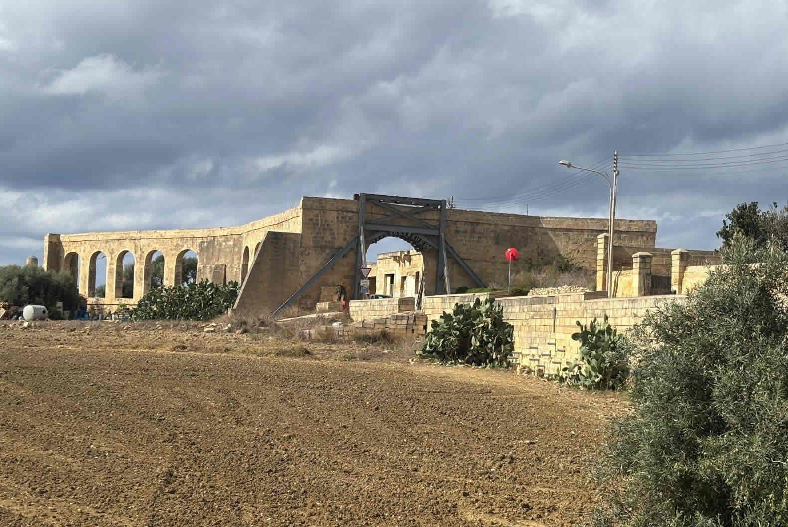
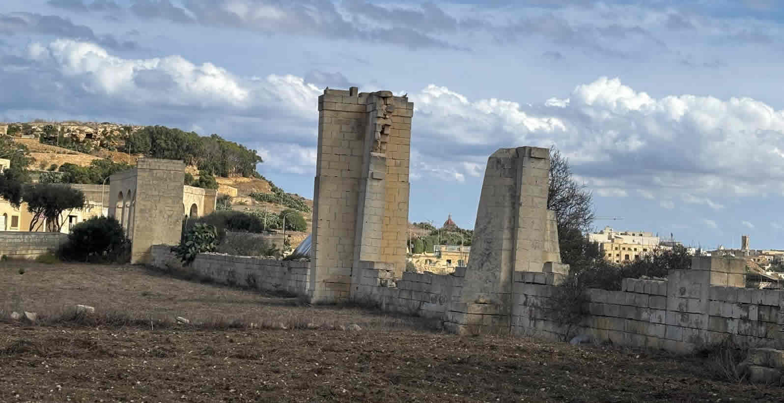
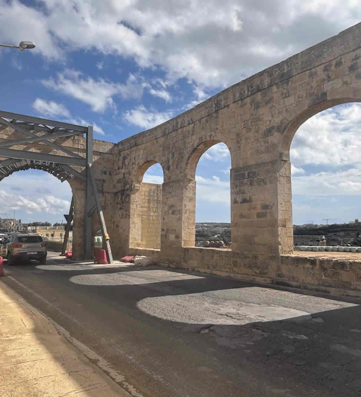
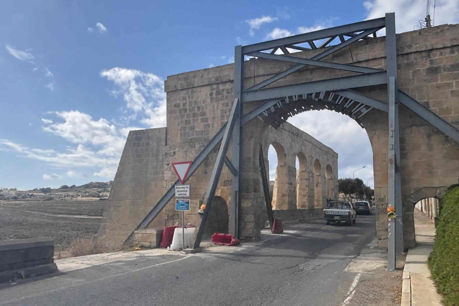
Source & Route: The water source was the cave (spring) at Għar Ilma in the limits of Kerċem. The water was carried along an above‑ground arcade / series of arches that are still partly visible.
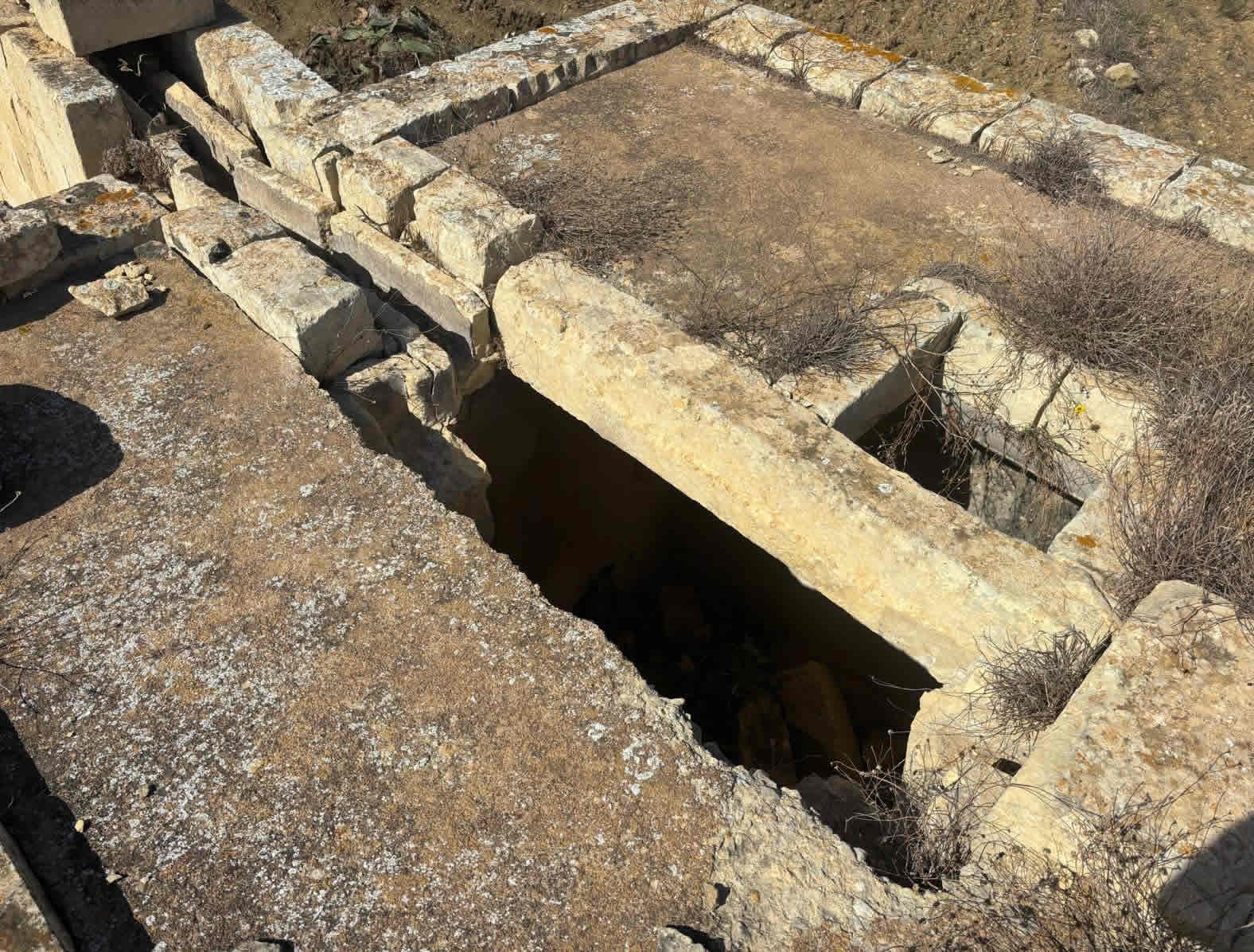
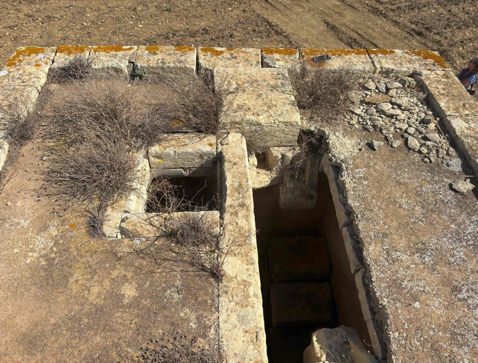
Reservoir: A large reservoir was built in the Cittadella’s ditch (Citadel, Victoria) to store water. This indicates that the water supply was intended not just to deliver, but to provide buffer capacity.
Commemorative Features: An obelisk near the reservoir to mark the arrival of water. The fountain in St Sabina Square was the first visible outlet in Victoria.
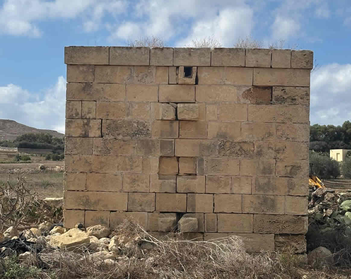
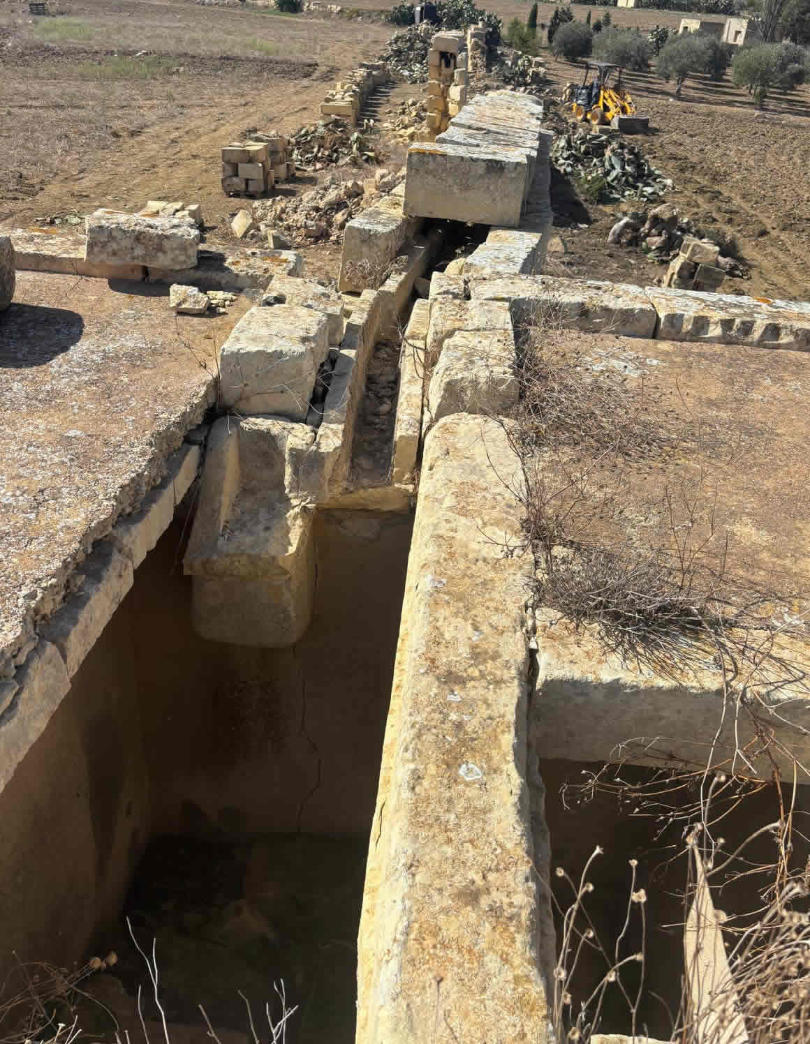
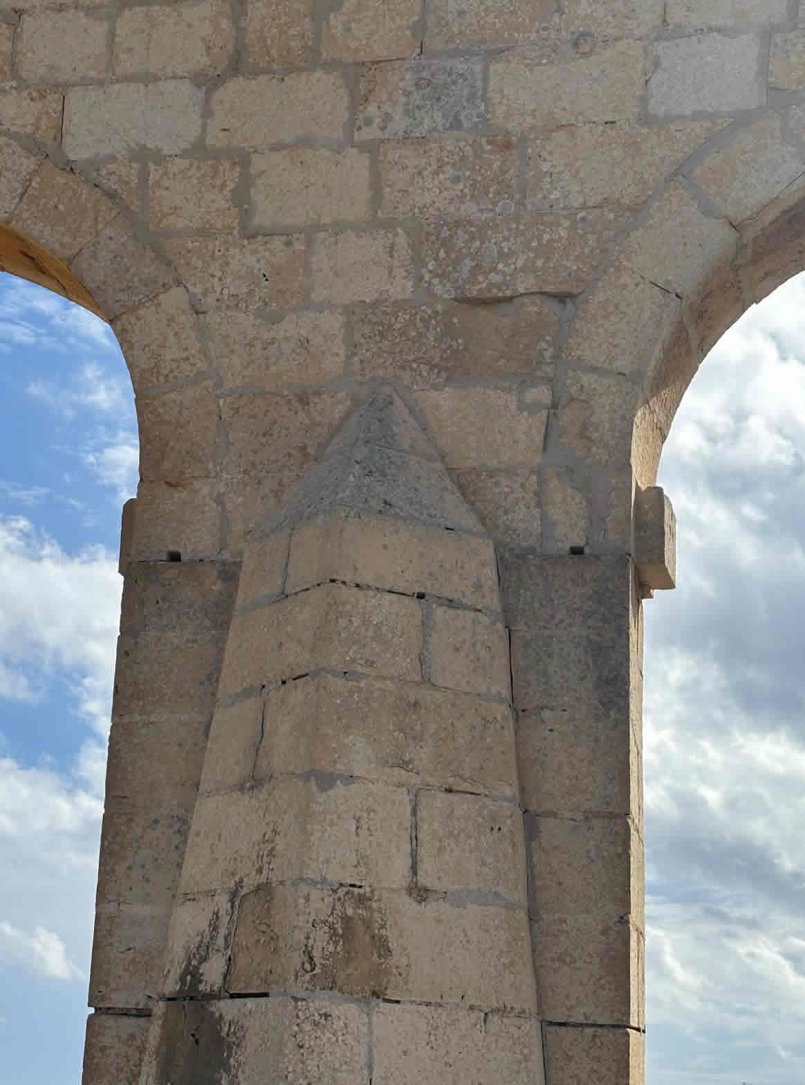
Materials & Construction Method: While I could not locate detailed construction blueprints, typical British period aqueducts in Malta used local limestone masonry for arches, stone or brick work for the channel, iron or lead pipes perhaps for sections, mortar bonding, etc. The above‑ground arcades/arches were built to carry the channel over dips / low ground. The foundations were stone; the arches are built of dressed / ashlar stone in many parts. Some sections are simply ruins now.
Decline & Damage
After the aqueduct’s function was replaced by more modern water supply systems (pipes + electrical pumping), the structure fell into disuse.
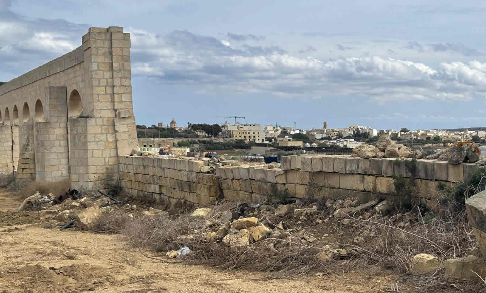
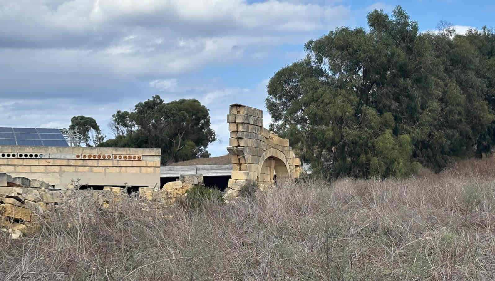
Over time, neglect, weather, and structural issues caused damage: many arches have collapsed, stones have been lost, parts leaning or failing. In particular a big collapse occurred in a storm in the 1980s.
Because of damage, parts of the aqueduct pose safety risks. Some arches required temporary shoring.
Restoration & Heritage Status
Heritage Protection: The Gozo Aqueduct has been granted Grade 1 protection by the Planning Authority.
Restoration Project: As of 2022 the Government of Gozo announced a restoration project to conserve, structurally consolidate, and preserve the aqueduct. The total cost is about €2 million.
Phases include: (a) geological investigation of subsoil / foundations; (b) temporary shoring of main arches; (c) structural consolidation of foundations and conservation of stone works.
The project is expected to be completed by end 2025.
Significance
As a 19th‑century infrastructure project, it illustrates British colonial engineering in Gozo, and the evolution of municipal/public water supply systems in Malta.
It is also valued culturally and visually: many of its arches survive, forming part of the landscape; it is a touristic / heritage landmark.
The new restoration reflects recognition of that heritage.
What is Less Clear (Gaps)
I didn’t find in public sources detailed cross‑sectional dimensions: e.g. height, width of arches, the diameter of the conduit/channel, slope/gradient, flow capacity, or materials used in the channel interior (lining, pipes).
Also less clear is exactly how much water was delivered (volume), how often maintenance was done, exact alignment in all sections (which sections were underground vs above ground).
Little detail in published sources about original finishing, ornamentation, or accessory structures (taps, fountains, outlets) beyond the major reservoir and fountain in Victoria.
The Gozo Aqueduct showing arcs, partial ruin, and restored sections. I couldn’t find a full published engineering diagram, but based on those images plus historical/archaeological sources, here’s a reconstructed schematic of how the aqueduct would have been built — showing arches, water channel, gradient, reservoir etc.
Schematic / Hypothetical Cross‑section & Plan Layout
This is a conceptual diagram (not from original plans) that combines what is known about the Gozo Aqueduct’s design. It is useful for understanding how it would have been built.
| High Ground: Spring Source |
| Għar Ilma (Kerċem Spring) |
| │ |
| Channel outlet from spring |
| (stone / masonry channel, gently sloped) |
| ↓ |
| Ground slope, dips, valleys → Arches spanning low points |
| (series of stone arches) |
| Top of arches supports water channel / lined trough |
| │ |
| ↓ Constant gentle gradient ‒ slope sufficient for gravity flow |
| (maintained even over undulating terrain) |
| ↓ |
| Reservoir in Victoria |
| Located in ditch of the Cittadella (Citadel) complex |
| Stores water delivered from spring via aqueduct arches |
| Includes inlet from aqueduct channel, probably overflow, |
| drainage / outlet points to supply fountains etc. |
| │ |
| ↓ |
| Distribution / Outlet |
| (fountain(s) in Victoria town, public taps etc.) |
Key Construction Features (Based on Historical Sources)
From what is known:
Spring & Channel: Water starts from the Għar Ilma cave spring. The initial channel would likely be raw masonry, possibly lined to reduce seepage. It needed a reliable slope so that water would flow by gravity.
Arches / Arcades: Where the terrain dips, arches are built to maintain consistent height/elevation of the channel. The water channel runs on top of these arches. The arches are stone / local limestone. Their foundations rest on solid ground; arches have voussoirs etc, probably with keystones.
Gradient / Slope: Gentle slope necessary. No exact figure in published sources for degrees, but slope must have been enough for flow but not so steep as to erode or accelerate (typical aqueduct gradient might be in the order of a few mm per meter to a few metres over a kilometre). In effect: consistent downward slope from spring to reservoir.
Reservoir: In Victoria, inside the ditch of the Citadel, a reservoir was built. Purpose: storage, regulation, to buffer supply in times of low flow, to supply the town. Has inlet from aqueduct, overflow outlets etc.
Fountain / Public Outlet: First outlet visible was a fountain in St Sabina Square, Victoria. So water would flow from reservoir or channel into that fountain for public use. Then possibly distribute further.